
Last updated: 2026-11-11
Delhi City Map Poster
Design Your Delhi PosterOrder this print
Free to design · Printed posters from $24.99, shipping included to 20 countries
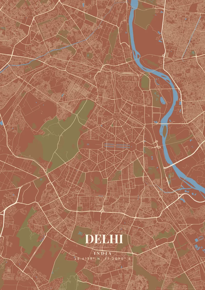
Delhi is one of the world's most ancient continuously inhabited cities, and its map reflects this with extraordinary complexity. New Delhi, the planned imperial capital designed by Edwin Lutyens in 1911, features a radically different character from Old Delhi: wide, formal diagonal avenues converge on India Gate and the Parliament, while Old Delhi, on the Yamuna's west bank, is a dense 17th-century labyrinth. The Yamuna River forms the eastern boundary.
Delhi from above
India's capital and second-largest city, Delhi, is home to landmarks spanning 1,500 years including the Qutb Minar, Humayun's Tomb, the Red Fort, and the new Parliament House. For a map poster, juxtaposing the geometric formality of Lutyens' New Delhi with the density of Old Delhi's Shahjahanabad creates an extraordinary visual narrative. Rich saffron, deep terracotta, or classic monochrome themes beautifully reflect Delhi's large historical and cultural depth.
Two very different street plans meet in central Delhi. Lutyens' design sets a long ceremonial axis, now named Kartavya Path, running from Rashtrapati Bhavan on Raisina Hill east to India Gate, with hexagonal roundabouts spreading outward along tree-lined roads. Just north, Connaught Place forms a set of concentric rings. Further north again, the walled city of Shahjahanabad sits on the Yamuna's west bank, with Chandni Chowk running from the Red Fort toward the Fatehpuri Masjid and the Jama Masjid rising above the lanes to the south. The forested Delhi Ridge, the last tail of the Aravalli hills, cuts a green band through the city, and Lodhi Garden adds a smaller patch of green around Sayyid and Lodi-era tombs. Zooming out reveals the Ring Road looping around the core and the floodplain that keeps East Delhi apart.
Delhi at a glance
- Where: India, at 28.61° N, 77.21° E.
- Mapped area: Delhi's boundary in OpenStreetMap spans about 18 km north to south and 20 km east to west.
- Nearest cities with a page: Jaipur (240 km), Mumbai (1150 km), Dhaka (1420 km).
Printed and shipped to your door
Design your Delhi map poster for free, then order it printed from the same editor. Posters print at 300 DPI on 170 gsm silk paper (A4 on 350 gsm card), and tracked shipping to 20 countries is included in every price. Each print is made to order within 3 business days, then usually arrives 3 to 6 business days after it ships (longer to Canada, Australia, Norway, New Zealand, Japan, Brazil and Mexico).
| Size | Dimensions | Poster |
|---|---|---|
| A4 | 8.3 × 11.7″ | $24.99 |
| 12 × 18″ | 30 × 46 cm | $34.99 |
| 16 × 20″ | 41 × 51 cm | $39.99 |
| 18 × 24″ | 46 × 61 cm | $44.99 |
| 12 × 12″ | 30 × 30 cm | $29.99 |
| 20 × 20″ | 50 × 50 cm | $44.99 |
Also framed (black, white or oak) from $79.99, on canvas from $69.99. Prices in USD, shipping included; checkout switches to EUR or GBP based on where you are. A print that arrives damaged is reprinted or refunded for free.
Frequently Asked Questions
Can I order a printed Delhi map poster?
Yes. Design your Delhi poster, then choose Order this print in the editor: a poster from $24.99, framed or on canvas, with tracked shipping to 20 countries included.
Can I customize the colors and style of my Delhi poster?
Yes. Pick from 50+ themes, then adjust the color palette, text overlay, fonts, and layout. You can add a title, subtitle, date, and GPS coordinates for Delhi. Everything is adjustable in the editor before you download.