
Last updated: 2026-11-11
Hobart — Custom Map Art
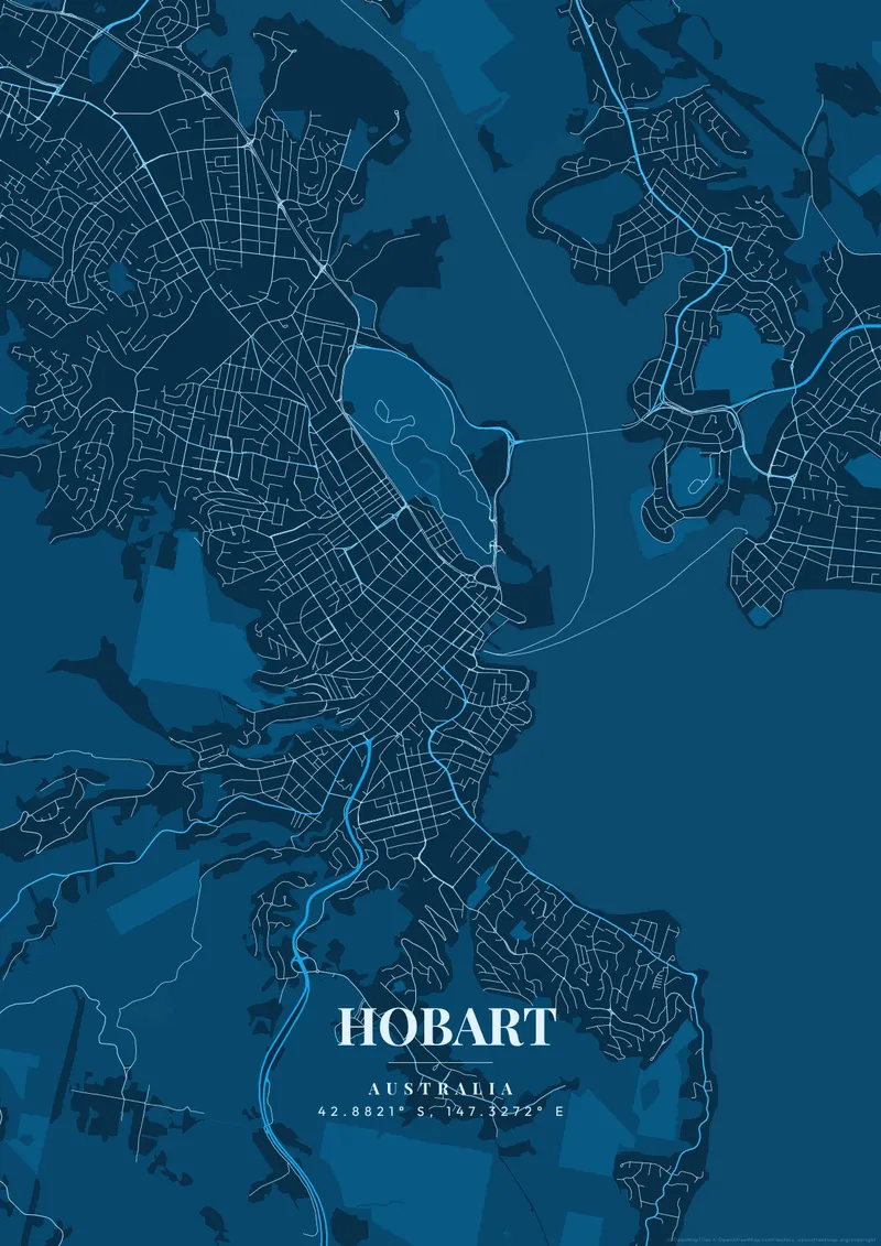
Design Your Hobart PosterOrder this print
Free to design · Printed posters from $24.99, shipping included to 20 countries
The historic, isolated grid of Australia's second-oldest capital hugs the freezing, deep estuarine waters of the winding Derwent River. The whole map is dominated by the often snow-capped peak of kunanyi / Mount Wellington, rising to the west.
What makes Hobart's map interesting
Serving as the final jumping-off point for large Antarctic expeditions, the city thrives with an intensely wild, independent island culture. Deep, freezing Antarctic navy, stark, terrifyingly steep mountain-slate, or crisp, unpolluted winter-white completely handle the rugged, beautiful isolation of Tasmania.
Hobart's central grid runs back from Sullivans Cove, where Constitution Dock and the sandstone warehouses of Salamanca Place line the waterfront. Battery Point climbs the small headland just south, its narrow streets of early colonial cottages wrapped around Arthur Circus, and Sandy Bay continues along the shore past the university toward Taroona. North of the city, the Queens Domain is a wooded hill holding the Royal Tasmanian Botanical Gardens, with the Tasman Bridge springing from its foot to Bellerive and Rosny on the eastern shore. The suburbs then follow the river north through New Town and Glenorchy toward MONA on its peninsula at Berriedale. A frame from the Domain to Battery Point keeps the cove central; widening it adds the slopes of kunanyi and the broad Derwent heading toward Storm Bay.
Hobart at a glance
- Where: Tasmania, Australia, at 42.88° S, 147.33° E.
- Mapped area: Hobart's boundary in OpenStreetMap spans about 11 km north to south and 14 km east to west.
- Nearest cities with a page: Melbourne (600 km), Sydney (1060 km), Adelaide (1160 km).
Printed and shipped to your door
Design your Hobart map poster for free, then order it printed from the same editor. Posters print at 300 DPI on 170 gsm silk paper (A4 on 350 gsm card), and tracked shipping to 20 countries is included in every price. Each print is made to order within 3 business days, then usually arrives 3 to 6 business days after it ships (longer to Canada, Australia, Norway, New Zealand, Japan, Brazil and Mexico).
| Size | Dimensions | Poster |
|---|---|---|
| A4 | 8.3 × 11.7″ | $24.99 |
| 12 × 18″ | 30 × 46 cm | $34.99 |
| 16 × 20″ | 41 × 51 cm | $39.99 |
| 18 × 24″ | 46 × 61 cm | $44.99 |
| 12 × 12″ | 30 × 30 cm | $29.99 |
| 20 × 20″ | 50 × 50 cm | $44.99 |
Also framed (black, white or oak) from $79.99, on canvas from $69.99. Prices in USD, shipping included; checkout switches to EUR or GBP based on where you are. A print that arrives damaged is reprinted or refunded for free.
Frequently Asked Questions
Can I order a printed Hobart map poster?
Yes. Design your Hobart poster, then choose Order this print in the editor: a poster from $24.99, framed or on canvas, with tracked shipping to 20 countries included.
Is the Hobart map poster really free?
You can design and download a Hobart map poster at 1080p with a small watermark at no cost. High-resolution versions (up to 7200px) without watermark are a one-time $6.99, and printed posters from $24.99 with shipping included. No subscription or account required.