
Last updated: 2026-11-11
Kuala Lumpur — Custom Map Art
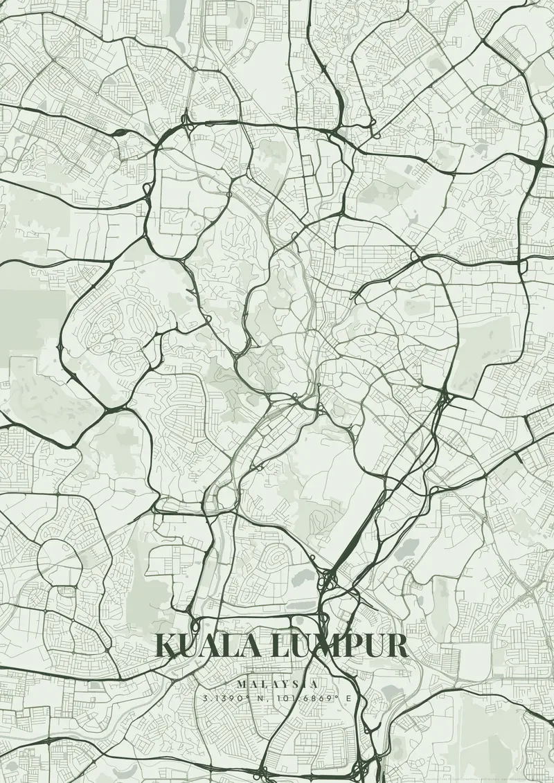
Start Your Kuala Lumpur PosterOrder this print
Free to design · Printed posters from $24.99, shipping included to 20 countries
Kuala Lumpur literally translates to 'muddy confluence', perfectly describing its geographical origin specifically at the exact point where the Klang and Gombak rivers merge. What was once a tiny tin-mining town is now an explosive, sprawling, high-tech mega-city bursting out into the deep, dark green jungle and surrounding limestone hills, notably the large Batu Caves.
What makes Kuala Lumpur's map interesting
The map is entirely dominated by the large, unmistakable twin footprints of the Petronas Towers acting as the epicenter of the hyper-modern KLCC district. Capturing this high-tech density surrounded by deep equatorial rainforest creates phenomenal depth. Sleek, high-tech shimmering silvers, deep jungle emeralds, or rich, humid purples honor the fast, futuristic pace of Malaysia.
At the confluence itself, the Masjid Jamek mosque sits on a point of land between the two rivers, with Merdeka Square and the Sultan Abdul Samad Building just to the west. Chinatown and Petaling Street lie south of the old center, close to Merdeka 118, which became the world's second-tallest building when it was completed in 2023. The KL Tower stands on Bukit Nanas, a forested hill inside the city, and Bukit Bintang's shopping district spreads to its southeast. Kampung Baru, a Malay village area of houses on small plots, sits north of the Petronas Towers. To the west, the Perdana Botanical Gardens surround a lake near the National Mosque, while KL Sentral and Brickfields lie farther south. A tight frame on the confluence shows the old colonial core; zooming out adds the Middle Ring Road loops, Titiwangsa Lake and Bangsar's ridges.
Kuala Lumpur at a glance
- Where: Malaysia, at 3.14° N, 101.69° E.
- Mapped area: Kuala Lumpur's boundary in OpenStreetMap spans about 23 km north to south and 16 km east to west.
- Nearest cities with a page: Singapore (310 km), Ho Chi Minh City (1010 km), Jakarta (1190 km).
Printed and shipped to your door
Design your Kuala Lumpur map poster for free, then order it printed from the same editor. Posters print at 300 DPI on 170 gsm silk paper (A4 on 350 gsm card), and tracked shipping to 20 countries is included in every price. Each print is made to order within 3 business days, then usually arrives 3 to 6 business days after it ships (longer to Canada, Australia, Norway, New Zealand, Japan, Brazil and Mexico).
| Size | Dimensions | Poster |
|---|---|---|
| A4 | 8.3 × 11.7″ | $24.99 |
| 12 × 18″ | 30 × 46 cm | $34.99 |
| 16 × 20″ | 41 × 51 cm | $39.99 |
| 18 × 24″ | 46 × 61 cm | $44.99 |
| 12 × 12″ | 30 × 30 cm | $29.99 |
| 20 × 20″ | 50 × 50 cm | $44.99 |
Also framed (black, white or oak) from $79.99, on canvas from $69.99. Prices in USD, shipping included; checkout switches to EUR or GBP based on where you are. A print that arrives damaged is reprinted or refunded for free.
Design your Kuala Lumpur print
Frequently Asked Questions
Can I order a printed Kuala Lumpur map poster?
Yes. Design your Kuala Lumpur poster, then choose Order this print in the editor: a poster from $24.99, framed or on canvas, with tracked shipping to 20 countries included.
Can I print a Kuala Lumpur map poster at home?
Yes. Download your Kuala Lumpur poster and print on thick matte or glossy photo paper. The standard version works well up to 8×10″, and the high-resolution export is sharp up to 18 × 24″ or A2. Or let us print it: printed posters from $24.99 with shipping included, framed or on canvas too.