
Last updated: 2026-11-11
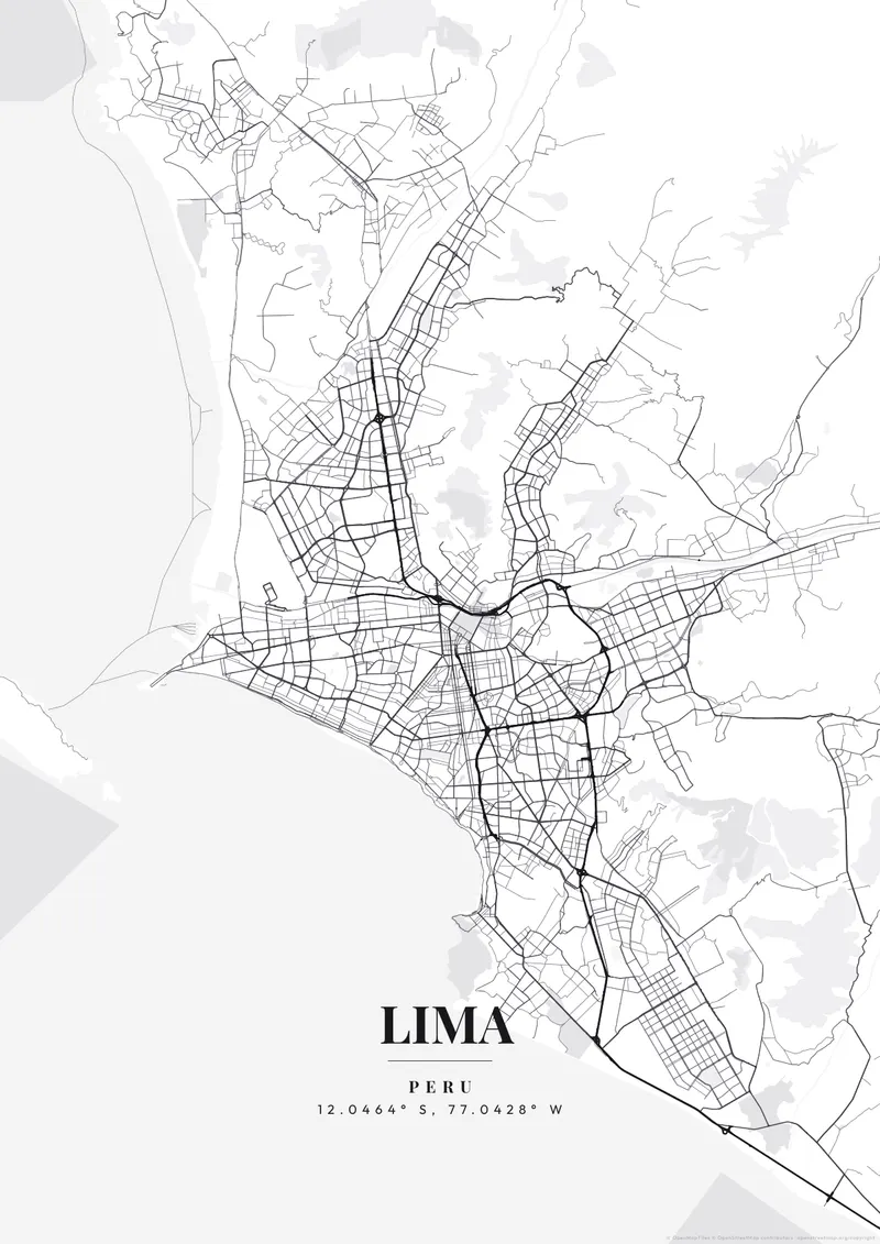
Lima, Peru Map Poster
Create Your Lima Map NowOrder this print
Free to design · Printed posters from $24.99, shipping included to 20 countries
Lima is a geographical anomaly, a sprawling, intensely dry desert mega-city that ends abruptly at the Costa Verde, a sheer cliff edge dropping extremely sharply down into the roaring expanse of the Pacific Ocean. Looking at a map, it seems as if half the city was sheared off by the ocean, leaving a dramatic, straight coastline.
The streets of Lima
Because it almost never rains, the city's ancient colonial grids and sprawling modern districts are colored in muted, dusty tones natively. Zooming in on the dense Miraflores district hugging the very edge of the towering cliffs overlooking the sea provides the perfect dramatic snapshot. Moody, foggy Pacific coastline greys, stark modern blacks, or deep architectural slate colorways effortlessly honor the culinary titan of South America.
The Historic Centre lies on the south bank of the Rímac River, its colonial grid centered on the Plaza de Armas, with the Rímac district and the steep Cerro San Cristóbal directly across the water. South of the center, the Vía Expresa, known locally as El Zanjón, cuts a sunken trench through the city toward Miraflores. San Isidro, the financial district, keeps El Olivar, a grove of old olive trees, between its office towers. In Miraflores, the adobe pyramid of Huaca Pucllana occupies a full block among apartment buildings, and Barranco continues south along the clifftops. The port of Callao and Jorge Chávez International Airport sit to the west, with La Punta extending into the ocean opposite San Lorenzo Island. A close frame on Miraflores and Barranco shows streets halting at the cliff edge; zooming out adds Callao's peninsula and the Rímac valley.
Lima at a glance
- Where: Province of Lima, Lima Metropolitan Area, Peru, at 12.05° S, 77.04° W.
- Mapped area: Lima's boundary in OpenStreetMap spans about 5 km north to south and 9 km east to west.
- Nearest cities with a page: Machu Picchu (500 km), Quito (1330 km), Bogotá (1890 km).
Printed and shipped to your door
Design your Lima map poster for free, then order it printed from the same editor. Posters print at 300 DPI on 170 gsm silk paper (A4 on 350 gsm card), and tracked shipping to 20 countries is included in every price. Each print is made to order within 3 business days, then usually arrives 3 to 6 business days after it ships (longer to Canada, Australia, Norway, New Zealand, Japan, Brazil and Mexico).
| Size | Dimensions | Poster |
|---|---|---|
| A4 | 8.3 × 11.7″ | $24.99 |
| 12 × 18″ | 30 × 46 cm | $34.99 |
| 16 × 20″ | 41 × 51 cm | $39.99 |
| 18 × 24″ | 46 × 61 cm | $44.99 |
| 12 × 12″ | 30 × 30 cm | $29.99 |
| 20 × 20″ | 50 × 50 cm | $44.99 |
Also framed (black, white or oak) from $79.99, on canvas from $69.99. Prices in USD, shipping included; checkout switches to EUR or GBP based on where you are. A print that arrives damaged is reprinted or refunded for free.
Frequently Asked Questions
Can I order a printed Lima map poster?
Yes. Design your Lima poster, then choose Order this print in the editor: a poster from $24.99, framed or on canvas, with tracked shipping to 20 countries included.
How do I add text and coordinates to my Lima poster?
Use the text overlay panel in the editor to add a title, subtitle, date, and GPS coordinates. You can change fonts, sizes, weight, and position. Lima's coordinates are pre-filled — just toggle them on.