
Last updated: 2026-11-11
Design a Nantes Map Poster
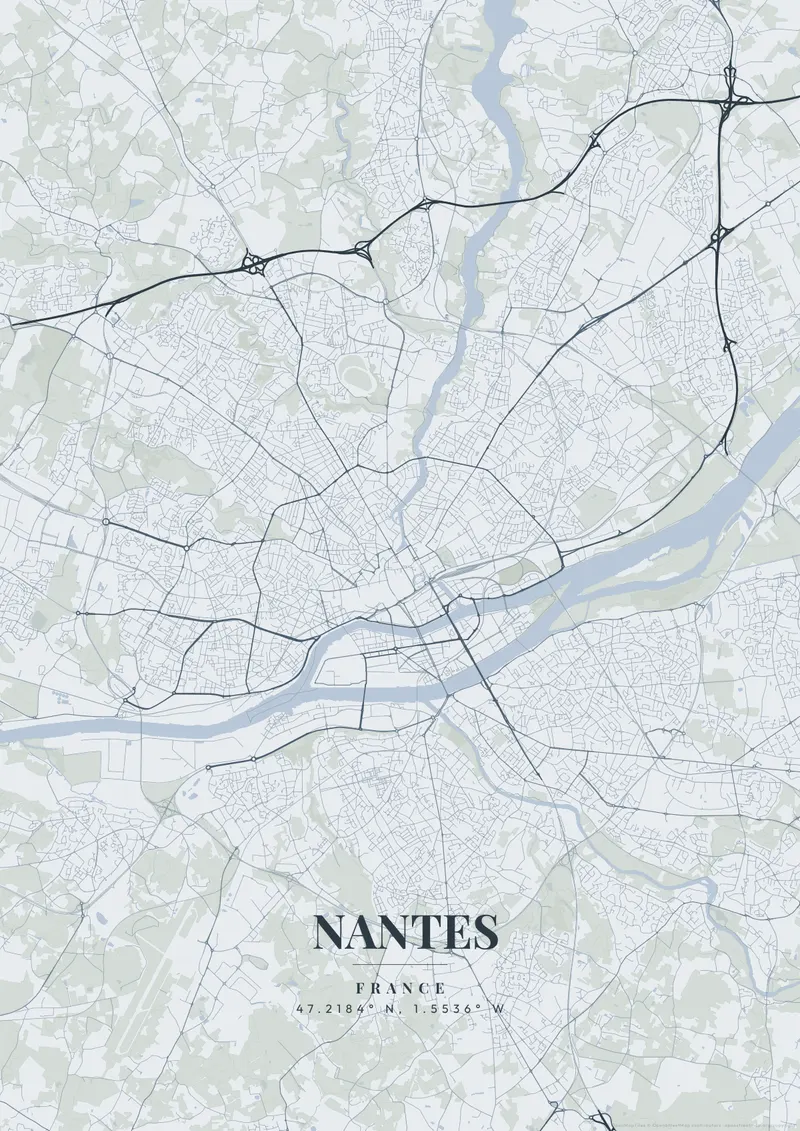
Create Your Nantes Map NowOrder this print
Free to design · Printed posters from $24.99, shipping included to 20 countries
Nantes sits on the Loire near where France's longest river widens toward the Atlantic, with the Erdre joining from the north. Once a great port, the city wraps around the Île de Nantes in the river, anchored by the moated Château des ducs de Bretagne and a grid of grand eighteenth-century avenues.
Nantes — the city's layout
A map of Nantes captures the Loire sweeping past the island and the historic core, a generous riverside layout. Loire blue, Breton slate, or warm limestone gold suit its creative, riverine character.
The map of Nantes still records rivers that were filled in: the Cours des 50 Otages runs over a stretch of the Erdre diverted into a tunnel, and the old Île Feydeau, once an island of shipowners' townhouses, is now surrounded by streets instead of water. To the east of it, the Bouffay quarter keeps a cluster of narrow medieval lanes near the cathedral, while the eighteenth-century Graslin quarter, with its theatre on Place Graslin, lies to the west. The Île de Nantes, a former shipbuilding area, stretches downstream as a long island between two arms of the Loire, and on the south bank the Sèvre Nantaise joins the river at Rezé, near the old fishing village of Trentemoult. A frame centered on the château shows the old core and the island together; zooming out follows the Loire as it widens west toward the estuary.
Nantes at a glance
- Where: France, at 47.22° N, 1.55° W.
- Nearest cities with a page: Bordeaux (280 km), Paris (340 km), Brighton (410 km).
Printed and shipped to your door
Design your Nantes map poster for free, then order it printed from the same editor. Posters print at 300 DPI on 170 gsm silk paper (A4 on 350 gsm card), and tracked shipping to 20 countries is included in every price. Each print is made to order within 3 business days, then usually arrives 3 to 6 business days after it ships (longer to Canada, Australia, Norway, New Zealand, Japan, Brazil and Mexico).
| Size | Dimensions | Poster |
|---|---|---|
| A4 | 8.3 × 11.7″ | $24.99 |
| 12 × 18″ | 30 × 46 cm | $34.99 |
| 16 × 20″ | 41 × 51 cm | $39.99 |
| 18 × 24″ | 46 × 61 cm | $44.99 |
| 12 × 12″ | 30 × 30 cm | $29.99 |
| 20 × 20″ | 50 × 50 cm | $44.99 |
Also framed (black, white or oak) from $79.99, on canvas from $69.99. Prices in USD, shipping included; checkout switches to EUR or GBP based on where you are. A print that arrives damaged is reprinted or refunded for free.
Frequently Asked Questions
Can I order a printed Nantes map poster?
Yes. Design your Nantes poster, then choose Order this print in the editor: a poster from $24.99, framed or on canvas, with tracked shipping to 20 countries included.
What file formats can I download?
Standard downloads are PNG at 1080p. The $6.99 high-resolution export unlocks up to 7200px in PNG, JPEG, WebP and PDF at 300 DPI, plus SVG vector files with the artistic themes.