
Last updated: 2026-11-11
Panama City — Custom Map Art
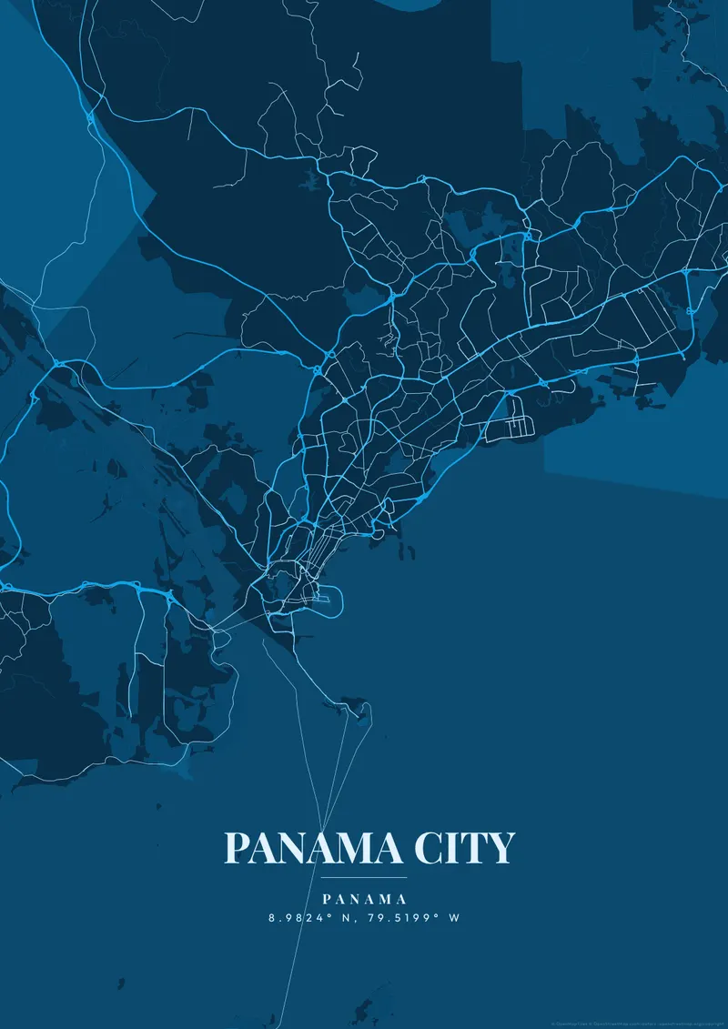
Design Your Panama City PosterOrder this print
Free to design · Printed posters from $24.99, shipping included to 20 countries
Panama City presents one of the most jarring, aggressive skylines against the deep blue of the Pacific Ocean. The city's geography is a long, highly developed coastal strip that curves along the Bay of Panama, abruptly halted by the dense, impenetrable green wall of the tropical rainforest right at the edge of the city limits.
What makes Panama City's map interesting
The contrast on the map is extreme: the dense, historic Casco Viejo peninsula, laid out on a grid in 1673, sitting directly adjacent to a jagged wall of hyper-modern, gleaming white skyscrapers. Highlighting this coastal curve dropping into the deep ocean creates phenomenal art. Vivid tropical teal, brilliant architectural white, or deep jungle canopy green map the humid, explosive growth of this vital global crossroads.
Casco Viejo, the city moved to this small peninsula in 1673 after the destruction of the first settlement, is laid out on a regular grid of narrow streets around Plaza de la Independencia. The Cinta Costera, a coastal road on reclaimed land, now wraps its seaward edge and runs northeast along Avenida Balboa toward the towers of Punta Paitilla and Punta Pacífica. Farther east, the ruins of Panamá Viejo, founded in 1519, sit by the shore beside the Corredor Sur viaduct. To the southwest, Ancón Hill rises above Balboa and the canal entrance, where the Bridge of the Americas spans the channel. The Amador Causeway, built from canal excavation spoil, connects a chain of small islands. A close frame shows Casco Viejo's grid against the bay; widening the view adds the canal, Albrook and the Metropolitan Natural Park.
Panama City at a glance
- Where: Distrito de Panamá, Panamá Province, Panama, at 8.98° N, 79.52° W.
- Mapped area: Panama City's boundary in OpenStreetMap spans about 36 km north to south and 35 km east to west.
- Nearest cities with a page: Cartagena (470 km), San Jose (510 km), Medellín (530 km).
Printed and shipped to your door
Design your Panama City map poster for free, then order it printed from the same editor. Posters print at 300 DPI on 170 gsm silk paper (A4 on 350 gsm card), and tracked shipping to 20 countries is included in every price. Each print is made to order within 3 business days, then usually arrives 3 to 6 business days after it ships (longer to Canada, Australia, Norway, New Zealand, Japan, Brazil and Mexico).
| Size | Dimensions | Poster |
|---|---|---|
| A4 | 8.3 × 11.7″ | $24.99 |
| 12 × 18″ | 30 × 46 cm | $34.99 |
| 16 × 20″ | 41 × 51 cm | $39.99 |
| 18 × 24″ | 46 × 61 cm | $44.99 |
| 12 × 12″ | 30 × 30 cm | $29.99 |
| 20 × 20″ | 50 × 50 cm | $44.99 |
Also framed (black, white or oak) from $79.99, on canvas from $69.99. Prices in USD, shipping included; checkout switches to EUR or GBP based on where you are. A print that arrives damaged is reprinted or refunded for free.
Frequently Asked Questions
Can I order a printed Panama City map poster?
Yes. Design your Panama City poster, then choose Order this print in the editor: a poster from $24.99, framed or on canvas, with tracked shipping to 20 countries included.
Can I print a Panama City map poster at home?
Yes. Download your Panama City poster and print on thick matte or glossy photo paper. The standard version works well up to 8×10″, and the high-resolution export is sharp up to 18 × 24″ or A2. Or let us print it: printed posters from $24.99 with shipping included, framed or on canvas too.