
Last updated: 2026-11-11
Design a Bologna Map Poster
Start Your Bologna PosterOrder this print
Free to design · Printed posters from $24.99, shipping included to 20 countries
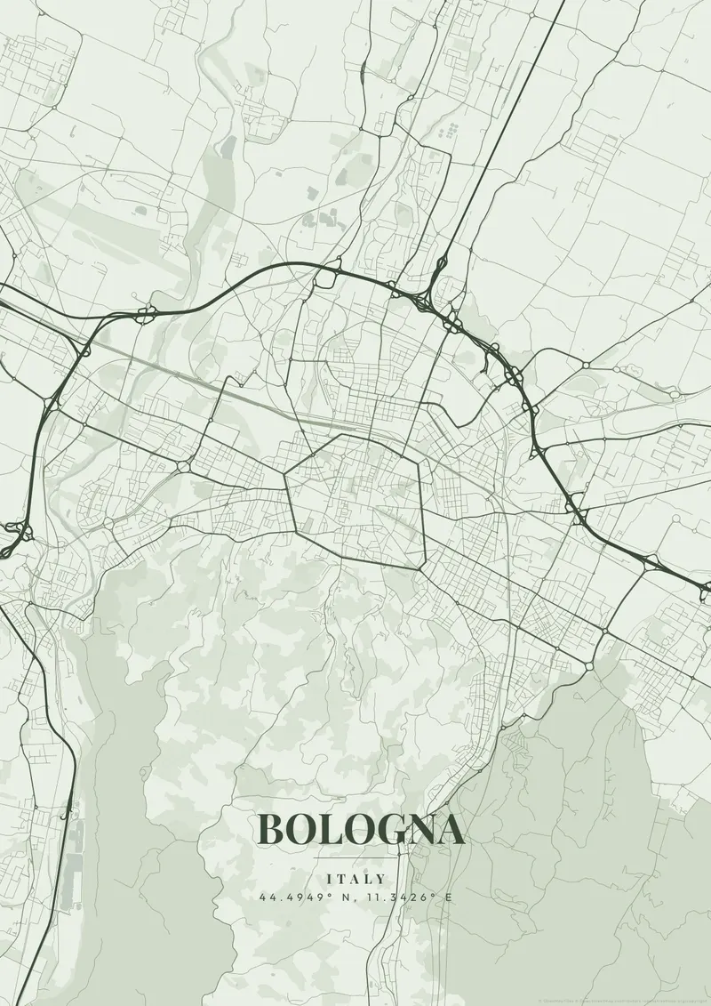
Bologna’s cartography reveals arguably the most pristine, radially expanding medieval street grid in Northern Italy. The map preserves its medieval heritage, shaped almost entirely by the faint outlines of ancient concentric ring walls. What makes the map texture completely unique from above is the endless, continuous network of 'porticoes', almost 40 kilometers of covered arcades completely shading the streets.
Bologna — the city's layout
Right at the nucleus of this expanding, circular medieval web stand the dizzyingly tall Leaning Towers of Bologna (Asinelli and Garisenda), creating intense visual tension. Warm, unmistakable, vibrant 'Bologna Red' (rosso), deep, scholarly terracotta, or rich, historical parchment perfectly honor the oldest continually operating university city on Earth and Italy's culinary capital.
Bologna's center lies inside a ring of boulevards, the viali, which follow the line of the last city wall; that wall came down in the early 20th century, but most of its gates still stand as landmarks, among them Porta Saragozza, Porta San Felice and Porta Galliera. The ancient Via Emilia crosses the old city in a near-straight line, carrying the names Via Ugo Bassi, Via Rizzoli and Strada Maggiore as it passes Piazza Maggiore. Via dell'Indipendenza runs north from the piazza to the railway station. South of the walls, the land rises into the Colli Bolognesi, and a covered walkway of 666 arches climbs from Porta Saragozza to the hilltop sanctuary of San Luca. A wide frame shows the contrast between those wooded hills and the flat Po plain to the north, crossed by the tangenziale and the A14.
Bologna at a glance
- Where: Emilia-Romagna, Italy, at 44.49° N, 11.34° E.
- Mapped area: Bologna's boundary in OpenStreetMap spans about 15 km north to south and 16 km east to west.
- Nearest cities with a page: Florence (81 km), Verona (110 km), Venice (130 km).
Printed and shipped to your door
Design your Bologna map poster for free, then order it printed from the same editor. Posters print at 300 DPI on 170 gsm silk paper (A4 on 350 gsm card), and tracked shipping to 20 countries is included in every price. Each print is made to order within 3 business days, then usually arrives 3 to 6 business days after it ships (longer to Canada, Australia, Norway, New Zealand, Japan, Brazil and Mexico).
| Size | Dimensions | Poster |
|---|---|---|
| A4 | 8.3 × 11.7″ | $24.99 |
| 12 × 18″ | 30 × 46 cm | $34.99 |
| 16 × 20″ | 41 × 51 cm | $39.99 |
| 18 × 24″ | 46 × 61 cm | $44.99 |
| 12 × 12″ | 30 × 30 cm | $29.99 |
| 20 × 20″ | 50 × 50 cm | $44.99 |
Also framed (black, white or oak) from $79.99, on canvas from $69.99. Prices in USD, shipping included; checkout switches to EUR or GBP based on where you are. A print that arrives damaged is reprinted or refunded for free.
Frequently Asked Questions
Can I order a printed Bologna map poster?
Yes. Design your Bologna poster, then choose Order this print in the editor: a poster from $24.99, framed or on canvas, with tracked shipping to 20 countries included.
How do I create a Bologna map poster?
Go to mapposter.xyz, search for Bologna, pick a theme, and customize the colors and text. You can download a standard version right away, get a high-resolution export (up to 7200px at 300 DPI) for $6.99, or order it as one of our printed posters from $24.99 with shipping included. No account needed.