
Last updated: 2026-11-11
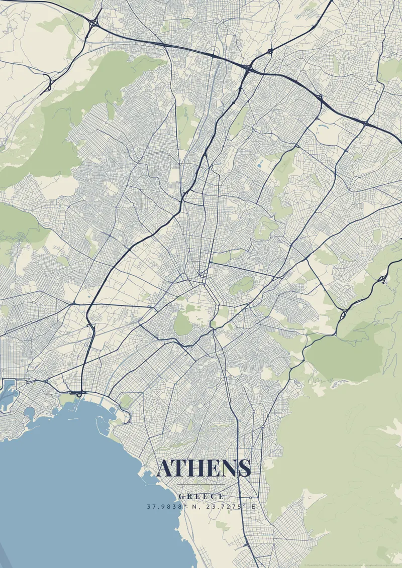
Athens City Map Poster
Build Your Athens Map ArtOrder this print
Free to design · Printed posters from $24.99, shipping included to 20 countries
Athens is a sprawling, chaotic sea of low-rise, white concrete that washes up against a series of steep, jagged limestone hills. From the air, the map is a dizzying, organic maze of ancient and modern streets that are subjugated by the monumental, flat-topped rocky outcrop of the Acropolis piercing the center of the city.
Athens from above
The perfectly rigid, ancient geometric footprint of the Parthenon sitting high above the surrounding, completely unstructured urbanization provides one of the most powerful cartographic contrasts in existence. Sun-bleached marble white, deep Mediterranean azure, or stark, classical midnight blue themes effortlessly capture the birthplace of Western civilization.
Directly below the Acropolis, the lanes of Plaka and the tiny hillside quarter of Anafiotika form the oldest-looking part of the map, and north of them Syntagma, Omonia and Monastiraki mark the corners of the commercial triangle laid out after Athens became the Greek capital in the 1830s. East of Syntagma, the National Garden and the horseshoe of the Panathenaic Stadium sit near Kolonaki, which climbs the slopes of Lycabettus, the tallest hill in central Athens. Syngrou Avenue runs south to the coast at Faliro, and Metro Line 1 links the center with the port of Piraeus on the Saronic Gulf. A tight frame from the Acropolis to Lycabettus captures the two hills and the triangle between them. Zooming out shows the whole Athens basin, enclosed by Mount Hymettus, Penteli, Parnitha and Aigaleo, with the sea along its southwestern edge.
Athens at a glance
- Where: Regional Unit of Central Athens, Attica, Greece, at 37.98° N, 23.73° E.
- Mapped area: Athens's boundary in OpenStreetMap spans about 36 km north to south and 28 km east to west.
- Nearest cities with a page: Santorini (230 km), Thessaloniki (300 km), Sofia (530 km).
Printed and shipped to your door
Design your Athens map poster for free, then order it printed from the same editor. Posters print at 300 DPI on 170 gsm silk paper (A4 on 350 gsm card), and tracked shipping to 20 countries is included in every price. Each print is made to order within 3 business days, then usually arrives 3 to 6 business days after it ships (longer to Canada, Australia, Norway, New Zealand, Japan, Brazil and Mexico).
| Size | Dimensions | Poster |
|---|---|---|
| A4 | 8.3 × 11.7″ | $24.99 |
| 12 × 18″ | 30 × 46 cm | $34.99 |
| 16 × 20″ | 41 × 51 cm | $39.99 |
| 18 × 24″ | 46 × 61 cm | $44.99 |
| 12 × 12″ | 30 × 30 cm | $29.99 |
| 20 × 20″ | 50 × 50 cm | $44.99 |
Also framed (black, white or oak) from $79.99, on canvas from $69.99. Prices in USD, shipping included; checkout switches to EUR or GBP based on where you are. A print that arrives damaged is reprinted or refunded for free.
Frequently Asked Questions
Can I order a printed Athens map poster?
Yes. Design your Athens poster, then choose Order this print in the editor: a poster from $24.99, framed or on canvas, with tracked shipping to 20 countries included.
What file formats can I download?
Standard downloads are PNG at 1080p. The $6.99 high-resolution export unlocks up to 7200px in PNG, JPEG, WebP and PDF at 300 DPI, plus SVG vector files with the artistic themes.