
Last updated: 2026-11-11
Design a Santorini Map Poster
Create Your Santorini Map NowOrder this print
Free to design · Printed posters from $24.99, shipping included to 20 countries
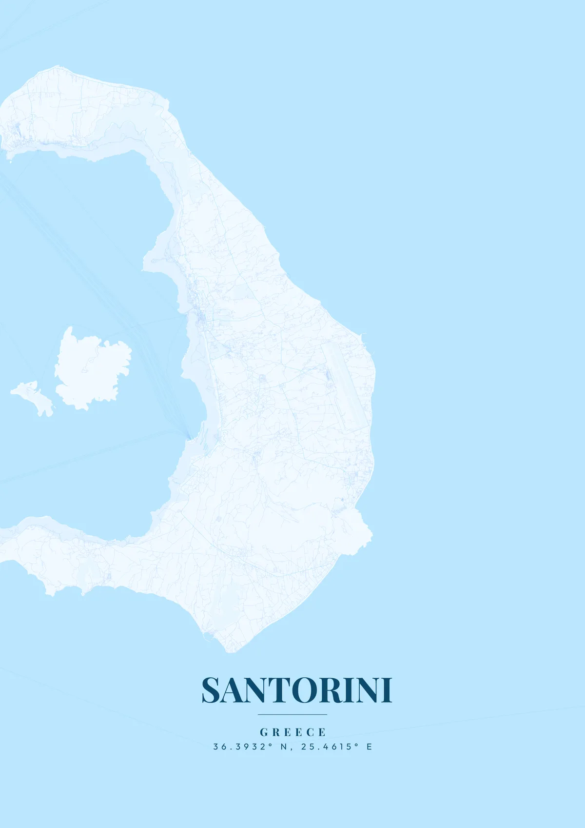
Santorini's map tells the story of one of the most violent volcanic eruptions in recorded history. The island is actually the crescent-shaped rim of a submerged caldera, its sheer western cliffs plunging 300 meters into the deep blue waters of the volcanic basin. Fira, the capital, perches along this dramatic cliff edge, while the iconic village of Oia crowns the northern tip. The eastern side slopes gently toward black sand beaches at Kamari and Perissa, divided by the ancient headland of Mesa Vouno where the ruins of Ancient Thera look down from 369 meters.
Santorini — the city's layout
The Minoan eruption of around 1600 BC, one of the largest volcanic events in the last 10,000 years, destroyed the island's center and may have inspired the legend of Atlantis. Today, the caldera contains the still-active volcanic islets of Nea Kameni and Palea Kameni, visible at the center of the map. Santorini produces distinctive wines from vines trained in ground-level baskets to resist the fierce Aegean winds. Aegean blue, brilliant white, or warm volcanic red capture the otherworldly beauty of this crescent-shaped island.
Along the caldera rim north of Fira, the villages of Firostefani and Imerovigli run together in a narrow line, with the rock of Skaros jutting out toward the water. Inland, Pyrgos climbs a hill near Profitis Ilias, the island's highest point at 567 meters, crowned by a monastery. In the southwest lies Akrotiri, the Bronze Age town buried by the eruption, near the Red Beach. On the caldera side, ferries dock at Athinios below the cliffs, while the old port of Fira is reached by a cable car and a zigzag path of steps. Below Oia, the small harbor of Ammoudi sits at the foot of red rock. Across the water, the islands of Thirasia and Aspronisi complete the ring. A close zoom on Oia shows its lanes along the cliff top; the full caldera view, Thirasia included, shows the circle the island once formed.
Santorini at a glance
- Where: Greece, at 36.39° N, 25.46° E.
- Nearest cities with a page: Athens (230 km), Thessaloniki (520 km), Istanbul (600 km).
Printed and shipped to your door
Design your Santorini map poster for free, then order it printed from the same editor. Posters print at 300 DPI on 170 gsm silk paper (A4 on 350 gsm card), and tracked shipping to 20 countries is included in every price. Each print is made to order within 3 business days, then usually arrives 3 to 6 business days after it ships (longer to Canada, Australia, Norway, New Zealand, Japan, Brazil and Mexico).
| Size | Dimensions | Poster |
|---|---|---|
| A4 | 8.3 × 11.7″ | $24.99 |
| 12 × 18″ | 30 × 46 cm | $34.99 |
| 16 × 20″ | 41 × 51 cm | $39.99 |
| 18 × 24″ | 46 × 61 cm | $44.99 |
| 12 × 12″ | 30 × 30 cm | $29.99 |
| 20 × 20″ | 50 × 50 cm | $44.99 |
Also framed (black, white or oak) from $79.99, on canvas from $69.99. Prices in USD, shipping included; checkout switches to EUR or GBP based on where you are. A print that arrives damaged is reprinted or refunded for free.
Frequently Asked Questions
Can I order a printed Santorini map poster?
Yes. Design your Santorini poster, then choose Order this print in the editor: a poster from $24.99, framed or on canvas, with tracked shipping to 20 countries included.
What’s the best free map poster generator?
MapPoster (mapposter.xyz) lets you create custom city map art of any location worldwide with 50+ themes. Standard downloads are available immediately; high-resolution exports (up to 7200px at 300 DPI) are $6.99, and printed posters from $24.99 with shipping included. No account required.