
Last updated: 2026-11-11
Baltimore, United States Map Poster
Build Your Baltimore Map ArtOrder this print
Free to design · Printed posters from $24.99, shipping included to 20 countries
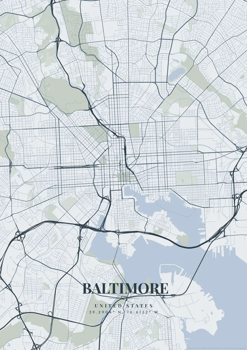
The urban layout of this intensely gritty, historic manufacturing powerhouse is entirely dictated by the deep, terrifyingly complex, crab-like inlets and docks of the Inner Harbor. The exceedingly tight, densely packed rows of historic red-brick housing terminate at the large, heavy industrial ports of the Patapsco River.
The streets of Baltimore
Home to the legendary, deafening, purple-clad crowds of Ravens fans at M&T Bank Stadium and a proud, unpretentious working-class attitude. Deep, immensely dark harbor navy, stark, blood-red brick-tones, or bold, intimidating raven-purple mirror the unbreakable, resilient soul of 'Charm City'.
Most of Baltimore's waterfront neighborhoods sit around the Northwest Harbor, the branch of the Patapsco that ends at the Inner Harbor. Federal Hill rises as a grassy bluff on its south side, Locust Point extends southeast to Fort McHenry at the tip of its peninsula, and Fells Point and Canton line the north shore to the east. Charles Street climbs north from downtown to Mount Vernon, where four small parks form a cross around the Washington Monument, while the Jones Falls valley and the expressway in it cut a diagonal toward the northwest. Two large Victorian parks, Druid Hill to the northwest and Patterson to the east, anchor the rowhouse districts, and Camden Yards sits just southwest of the harbor. A close frame on the Inner Harbor shows the piers and street grid; zooming out adds the Middle Branch and the long harbor channel.
Baltimore at a glance
- Where: Maryland, United States, at 39.29° N, 76.61° W.
- Mapped area: Baltimore's boundary in OpenStreetMap spans about 19 km north to south and 16 km east to west.
- Nearest cities with a page: Annapolis (36 km), Washington D.C. (56 km), Philadelphia (140 km).
Printed and shipped to your door
Design your Baltimore map poster for free, then order it printed from the same editor. Posters print at 300 DPI on 170 gsm silk paper (A4 on 350 gsm card), and tracked shipping to 20 countries is included in every price. Each print is made to order within 3 business days, then usually arrives 3 to 6 business days after it ships (longer to Canada, Australia, Norway, New Zealand, Japan, Brazil and Mexico).
| Size | Dimensions | Poster |
|---|---|---|
| A4 | 8.3 × 11.7″ | $24.99 |
| 12 × 18″ | 30 × 46 cm | $34.99 |
| 16 × 20″ | 41 × 51 cm | $39.99 |
| 18 × 24″ | 46 × 61 cm | $44.99 |
| 12 × 12″ | 30 × 30 cm | $29.99 |
| 20 × 20″ | 50 × 50 cm | $44.99 |
Also framed (black, white or oak) from $79.99, on canvas from $69.99. Prices in USD, shipping included; checkout switches to EUR or GBP based on where you are. A print that arrives damaged is reprinted or refunded for free.
Frequently Asked Questions
Can I order a printed Baltimore map poster?
Yes. Design your Baltimore poster, then choose Order this print in the editor: a poster from $24.99, framed or on canvas, with tracked shipping to 20 countries included.
How do I create a Baltimore map poster?
Go to mapposter.xyz, search for Baltimore, pick a theme, and customize the colors and text. You can download a standard version right away, get a high-resolution export (up to 7200px at 300 DPI) for $6.99, or order it as one of our printed posters from $24.99 with shipping included. No account needed.