
Last updated: 2026-11-11
Charleston City Map Poster
Build Your Charleston Map ArtOrder this print
Free to design · Printed posters from $24.99, shipping included to 20 countries
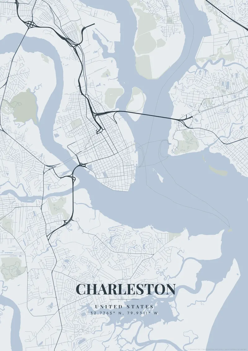
Charleston sits on a narrow peninsula where the Ashley and Cooper rivers meet before opening into the Atlantic — locals like to say the two rivers join to form the ocean. The historic district fans out in a tight grid of cobbled streets, with the Battery at the southern tip and church steeples earning it the nickname the Holy City.
Charleston from above
A map poster of Charleston captures that slender peninsula cradled by water, a shape unlike any other American city. Soft pastel tones echoing Rainbow Row, classic harbor navy, or warm sepia all flatter its antebellum charm.
On the peninsula, King Street runs north from the lower historic district as the main shopping street, with Meeting Street parallel to it and East Bay Street following the old Cooper River waterfront past Rainbow Row and Waterfront Park. Broad Street crosses the peninsula as a dividing line, and the residential blocks below it, known as South of Broad, run down to White Point Garden at the Battery. Farther north, Marion Square opens up the grid, and the Crosstown, part of US 17, cuts across toward the Ashley River bridges and West Ashley. Over the Cooper, the cable-stayed Ravenel Bridge links the city to Mount Pleasant. A frame centered on the lower peninsula fits the old town; widening to the whole harbor brings in Fort Sumter, James Island and Sullivan's Island.
Charleston at a glance
- Where: United States, at 32.78° N, 79.93° W.
- Nearest cities with a page: Savannah (130 km), Charlotte (290 km), Asheville (400 km).
Printed and shipped to your door
Design your Charleston map poster for free, then order it printed from the same editor. Posters print at 300 DPI on 170 gsm silk paper (A4 on 350 gsm card), and tracked shipping to 20 countries is included in every price. Each print is made to order within 3 business days, then usually arrives 3 to 6 business days after it ships (longer to Canada, Australia, Norway, New Zealand, Japan, Brazil and Mexico).
| Size | Dimensions | Poster |
|---|---|---|
| A4 | 8.3 × 11.7″ | $24.99 |
| 12 × 18″ | 30 × 46 cm | $34.99 |
| 16 × 20″ | 41 × 51 cm | $39.99 |
| 18 × 24″ | 46 × 61 cm | $44.99 |
| 12 × 12″ | 30 × 30 cm | $29.99 |
| 20 × 20″ | 50 × 50 cm | $44.99 |
Also framed (black, white or oak) from $79.99, on canvas from $69.99. Prices in USD, shipping included; checkout switches to EUR or GBP based on where you are. A print that arrives damaged is reprinted or refunded for free.
Frequently Asked Questions
Can I order a printed Charleston map poster?
Yes. Design your Charleston poster, then choose Order this print in the editor: a poster from $24.99, framed or on canvas, with tracked shipping to 20 countries included.
Can I customize the colors and style of my Charleston poster?
Yes. Pick from 50+ themes, then adjust the color palette, text overlay, fonts, and layout. You can add a title, subtitle, date, and GPS coordinates for Charleston. Everything is adjustable in the editor before you download.