
Last updated: 2026-11-11
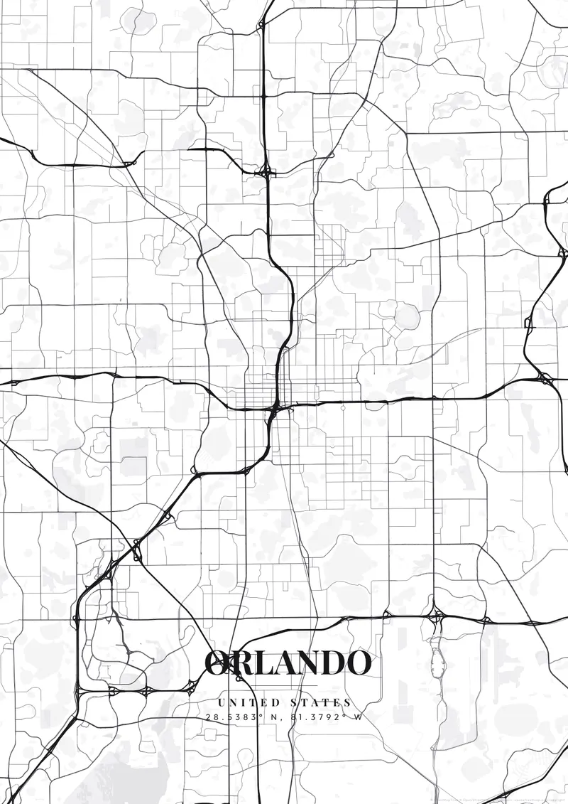
Orlando City Map Poster
Build Your Orlando Map ArtOrder this print
Free to design · Printed posters from $24.99, shipping included to 20 countries
Orlando is geographically bizarre compared to coastal mega-cities: sitting flat in the center of the Florida peninsula, its map is dotted with about a hundred round lakes, many of them old sinkholes. The street grid is forced to warp, bend, and completely detour around this chaotic network of water bodies, preventing any true, clean grid from taking hold.
Orlando from above
Aside from the lakes, the irregular footprints of the sprawling theme park complexes in the southwest dominate the cartography, creating monstrous, contained urban bubbles. Highlighting the dense downtown nestled among the deep blue, circular lakes makes for a fascinating natural map. Bright, humid tropical greens, deep lake blues, or sunny citrus tones perfectly embody this large entertainment capital.
Interstate 4 cuts across the map on a long diagonal, running southwest to northeast right past downtown, and much of the region's tourist landscape strings along it: International Drive and Universal Orlando lie a few miles southwest of the center, and Walt Disney World sits farther out near Lake Buena Vista, beyond the city limits. Downtown itself is a compact grid around Lake Eola, with Thornton Park to its east and College Park to the northwest, where streets carry university names such as Princeton, Harvard and Yale. Just north, Winter Park's chain of lakes is linked by narrow canals. Orlando International Airport's long parallel runways occupy a large block of the southeast. A close zoom on Lake Eola reads almost like a small-town plan, while a view stretching from Winter Park to the theme parks shows how the interstate stitches the metro together.
Orlando at a glance
- Where: Orange County, Florida, United States, at 28.54° N, 81.38° W.
- Mapped area: Orlando's boundary in OpenStreetMap spans about 30 km north to south and 37 km east to west.
- Nearest cities with a page: Miami (330 km), Savannah (390 km), Key West (440 km).
Printed and shipped to your door
Design your Orlando map poster for free, then order it printed from the same editor. Posters print at 300 DPI on 170 gsm silk paper (A4 on 350 gsm card), and tracked shipping to 20 countries is included in every price. Each print is made to order within 3 business days, then usually arrives 3 to 6 business days after it ships (longer to Canada, Australia, Norway, New Zealand, Japan, Brazil and Mexico).
| Size | Dimensions | Poster |
|---|---|---|
| A4 | 8.3 × 11.7″ | $24.99 |
| 12 × 18″ | 30 × 46 cm | $34.99 |
| 16 × 20″ | 41 × 51 cm | $39.99 |
| 18 × 24″ | 46 × 61 cm | $44.99 |
| 12 × 12″ | 30 × 30 cm | $29.99 |
| 20 × 20″ | 50 × 50 cm | $44.99 |
Also framed (black, white or oak) from $79.99, on canvas from $69.99. Prices in USD, shipping included; checkout switches to EUR or GBP based on where you are. A print that arrives damaged is reprinted or refunded for free.
Frequently Asked Questions
Can I order a printed Orlando map poster?
Yes. Design your Orlando poster, then choose Order this print in the editor: a poster from $24.99, framed or on canvas, with tracked shipping to 20 countries included.
Can I customize the colors and style of my Orlando poster?
Yes. Pick from 50+ themes, then adjust the color palette, text overlay, fonts, and layout. You can add a title, subtitle, date, and GPS coordinates for Orlando. Everything is adjustable in the editor before you download.