
Last updated: 2026-11-11
Providence Map Poster
Build Your Providence Map ArtOrder this print
Free to design · Printed posters from $24.99, shipping included to 20 countries
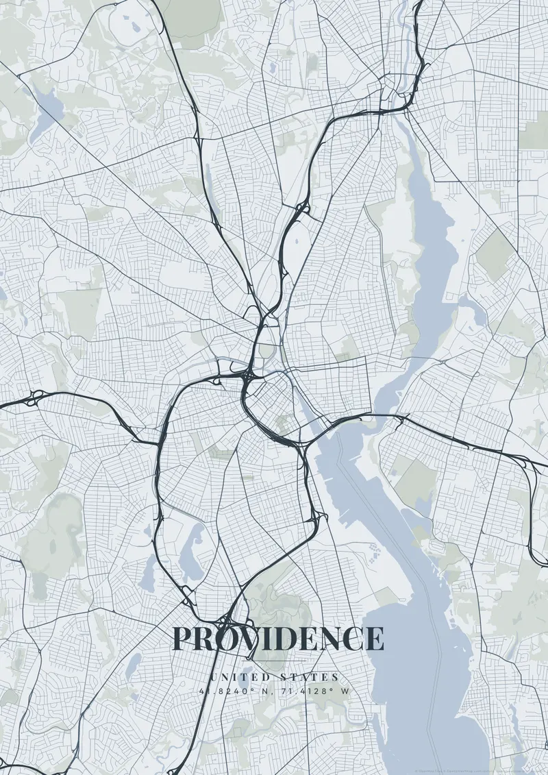
Providence sits at the head of Narragansett Bay, where the Woonasquatucket and Moshassuck rivers join to form the Providence River through downtown. Historic College Hill rises steeply on the east side, home to Brown University and one of the best-preserved colonial neighbourhoods in America, its narrow streets looking out over the water.
Providence on the map
A map of Providence captures the rivers meeting beneath the college hill, a compact and elegant New England layout. Ivy-league navy, colonial cream, or deep harbour teal suit its scholarly, historic character.
Downtown Providence was reshaped in the late twentieth century, when its rivers were uncovered and moved to create Waterplace Park and a river walk lined with footbridges. The marble-domed State House stands on Smith Hill just north of downtown, and Federal Hill, with Atwells Avenue as its main street, lies to the west across Interstate 95. On the East Side, Benefit Street follows the slope of College Hill, and the neighborhood ends at the Seekonk River, with Fox Point and India Point Park at its southern end where the Providence River widens toward the bay. Roger Williams Park, with its ponds, fills a large area on the city's south side. A close view on downtown takes in the State House, Waterplace, and College Hill together; pulling back reveals the Seekonk and the upper reaches of Narragansett Bay.
Providence at a glance
- Where: United States, at 41.82° N, 71.41° W.
- Nearest cities with a page: Boston (66 km), Brooklyn (250 km), New York (250 km).
Printed and shipped to your door
Design your Providence map poster for free, then order it printed from the same editor. Posters print at 300 DPI on 170 gsm silk paper (A4 on 350 gsm card), and tracked shipping to 20 countries is included in every price. Each print is made to order within 3 business days, then usually arrives 3 to 6 business days after it ships (longer to Canada, Australia, Norway, New Zealand, Japan, Brazil and Mexico).
| Size | Dimensions | Poster |
|---|---|---|
| A4 | 8.3 × 11.7″ | $24.99 |
| 12 × 18″ | 30 × 46 cm | $34.99 |
| 16 × 20″ | 41 × 51 cm | $39.99 |
| 18 × 24″ | 46 × 61 cm | $44.99 |
| 12 × 12″ | 30 × 30 cm | $29.99 |
| 20 × 20″ | 50 × 50 cm | $44.99 |
Also framed (black, white or oak) from $79.99, on canvas from $69.99. Prices in USD, shipping included; checkout switches to EUR or GBP based on where you are. A print that arrives damaged is reprinted or refunded for free.
Frequently Asked Questions
Can I order a printed Providence map poster?
Yes. Design your Providence poster, then choose Order this print in the editor: a poster from $24.99, framed or on canvas, with tracked shipping to 20 countries included.
What themes are available?
MapPoster has 50+ themes: 50+ artistic vector styles, including classic city maps with street names (Minimal White, Midnight Dark, Modern Voyager), plus OpenStreetMap and satellite map tiles. Artistic themes render every road and waterway in custom color palettes — from moody dark tones to bright pastels.