
Last updated: 2026-11-11
San Antonio Map Poster
Build Your San Antonio Map ArtOrder this print
Free to design · Printed posters from $24.99, shipping included to 20 countries
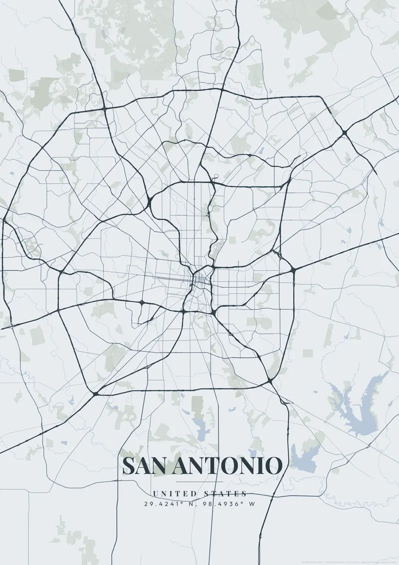
San Antonio presents a fascinating, layered cartographic history. The modern city represents extreme Texas expansion, surrounded by enormous, sweeping interstate loops. However, the exact heart of the city is entirely governed by the tiny, deeply sunken, winding limestone channel of the San Antonio River Walk, an intimately scaled waterway hidden right beneath the towering downtown grid.
San Antonio on the map
This contrast on the map is stunning: sun-baked, car-centric Texas sprawl giving way to the winding River Walk, built in 1939-41, below the downtown streets. Warm, dusty limestone beige, deep historic reds, or completely stark monochromatic themes beautifully suit the deeply historic, culturally blended hub of Texas.
Downtown, the River Walk forms a horseshoe-shaped bend below street level, with an added flood-control channel closing the loop. North of downtown, the Museum Reach follows the river to the redeveloped Pearl brewery complex and on to Brackenridge Park. To the south, the Mission Reach carries the trail past the King William historic district and the 18th-century missions Concepción, San José, San Juan and Espada, which form a UNESCO World Heritage Site together with the Alamo. Hemisfair, site of the 1968 World's Fair, lies southeast of the center with the Tower of the Americas. The downtown street pattern is irregular, bending around the river and old Spanish plazas such as Main Plaza. Loop 410 and Loop 1604 circle the city at increasing distance. A close frame on the river horseshoe shows its looping shape; widening it adds the thin green line of the river trail.
San Antonio at a glance
- Where: Bexar County, Texas, United States, at 29.42° N, 98.49° W.
- Mapped area: San Antonio's boundary in OpenStreetMap spans about 61 km north to south and 57 km east to west.
- Nearest cities with a page: Austin (120 km), Houston (300 km), Dallas (410 km).
Printed and shipped to your door
Design your San Antonio map poster for free, then order it printed from the same editor. Posters print at 300 DPI on 170 gsm silk paper (A4 on 350 gsm card), and tracked shipping to 20 countries is included in every price. Each print is made to order within 3 business days, then usually arrives 3 to 6 business days after it ships (longer to Canada, Australia, Norway, New Zealand, Japan, Brazil and Mexico).
| Size | Dimensions | Poster |
|---|---|---|
| A4 | 8.3 × 11.7″ | $24.99 |
| 12 × 18″ | 30 × 46 cm | $34.99 |
| 16 × 20″ | 41 × 51 cm | $39.99 |
| 18 × 24″ | 46 × 61 cm | $44.99 |
| 12 × 12″ | 30 × 30 cm | $29.99 |
| 20 × 20″ | 50 × 50 cm | $44.99 |
Also framed (black, white or oak) from $79.99, on canvas from $69.99. Prices in USD, shipping included; checkout switches to EUR or GBP based on where you are. A print that arrives damaged is reprinted or refunded for free.
Frequently Asked Questions
Can I order a printed San Antonio map poster?
Yes. Design your San Antonio poster, then choose Order this print in the editor: a poster from $24.99, framed or on canvas, with tracked shipping to 20 countries included.
What sizes can I print a San Antonio map poster?
Printed posters come in A4, 12 × 18″, 16 × 20″ and 18 × 24″, or square 30 × 30 cm and 50 × 50 cm, from $24.99 with shipping included, and framed or on canvas too. To print it yourself, the high-resolution export (up to 7200 pixels at 300 DPI) is sharp up to 18 × 24″ or A2. Standard downloads are 1080p — good for 8×10″ or digital use.