
Last updated: 2026-11-11
Santa Fe — Custom Map Art
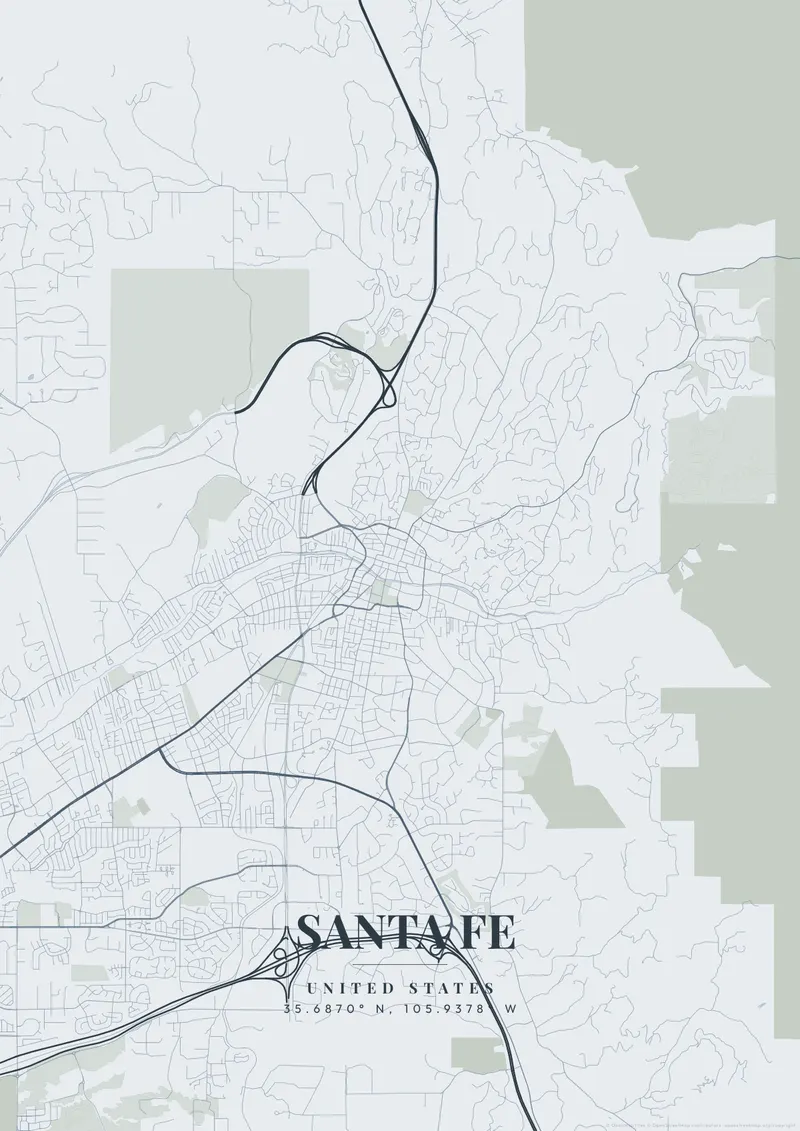
Build Your Santa Fe Map ArtOrder this print
Free to design · Printed posters from $24.99, shipping included to 20 countries
Santa Fe, founded in 1610 and the oldest state capital in the United States, grew around its central Plaza rather than a strict grid, so its older streets wander in narrow, adobe-lined curves. Sitting above 7,000 feet in the foothills of the Sangre de Cristo Mountains, the city's irregular plan reflects centuries of Pueblo, Spanish, and Mexican history.
What makes Santa Fe's map interesting
A Santa Fe map poster captures that maze-like historic core fanning out from the Plaza toward the high desert. Terracotta and adobe tans, turquoise accents, or sunset orange suit its Southwestern palette perfectly.
At the center of Santa Fe, the Plaza is flanked on its north side by the Palace of the Governors, and the streets just east lead to the Cathedral Basilica of St. Francis of Assisi. Southeast of downtown, Canyon Road climbs gently along the narrow Santa Fe River, roughly parallel to the Acequia Madre, a colonial irrigation ditch that still carries water. To the southwest, the Railyard district marks where the New Mexico Rail Runner Express ends its run from Albuquerque, next to a park built on old rail land. Cerrillos Road heads southwest from there as a long commercial corridor, and St. Francis Drive runs north to south across the city. A close zoom on the Plaza captures the irregular old core. A wider frame adds Museum Hill, the I-25 corridor along the south side, and the NM 599 relief route sweeping around the west.
Santa Fe at a glance
- Where: United States, at 35.69° N, 105.94° W.
- Nearest cities with a page: Denver (460 km), Scottsdale (600 km), Phoenix (610 km).
Printed and shipped to your door
Design your Santa Fe map poster for free, then order it printed from the same editor. Posters print at 300 DPI on 170 gsm silk paper (A4 on 350 gsm card), and tracked shipping to 20 countries is included in every price. Each print is made to order within 3 business days, then usually arrives 3 to 6 business days after it ships (longer to Canada, Australia, Norway, New Zealand, Japan, Brazil and Mexico).
| Size | Dimensions | Poster |
|---|---|---|
| A4 | 8.3 × 11.7″ | $24.99 |
| 12 × 18″ | 30 × 46 cm | $34.99 |
| 16 × 20″ | 41 × 51 cm | $39.99 |
| 18 × 24″ | 46 × 61 cm | $44.99 |
| 12 × 12″ | 30 × 30 cm | $29.99 |
| 20 × 20″ | 50 × 50 cm | $44.99 |
Also framed (black, white or oak) from $79.99, on canvas from $69.99. Prices in USD, shipping included; checkout switches to EUR or GBP based on where you are. A print that arrives damaged is reprinted or refunded for free.
Frequently Asked Questions
Can I order a printed Santa Fe map poster?
Yes. Design your Santa Fe poster, then choose Order this print in the editor: a poster from $24.99, framed or on canvas, with tracked shipping to 20 countries included.
How do I add text and coordinates to my Santa Fe poster?
Use the text overlay panel in the editor to add a title, subtitle, date, and GPS coordinates. You can change fonts, sizes, weight, and position. Santa Fe's coordinates are pre-filled — just toggle them on.